Djanet Real Estate: Investing in Southern Algeria Despite Climatic Risks
In 2026, Djanet emerges as one of the most promising tourist destinations in southern Algeria. Yet, a sudden flash flood recently trapped foreign tourists for over 28 hours, highlighting the vulnerabilities of real estate projects in desert regions. This situation raises fundamental questions for investors: How to assess climatic risks? Which areas are safest? Explore the <a href="/price-map-algeria">real estate price map</a>, updated daily by wilaya, to identify plots with low flood exposure.
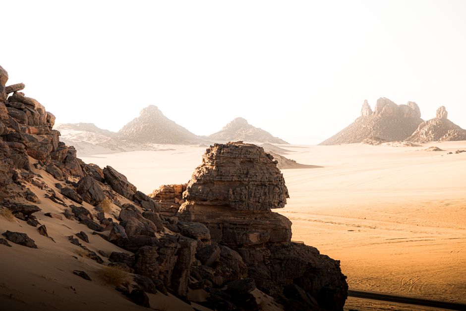
Sudden Floods Threaten Real Estate Projects
Deserts are not risk-free. Contrary to common belief, desert areas like Djanet experience rare but extremely intense torrential rains. According to data from the National Meteorological Office (ONM), between 2010 and 2025, Djanet recorded 7 major flood events, three of which involved population displacement or rescue operations. These phenomena, known as "basin floods," occur when intense rainfall accumulates in dry riverbeds (oueds), causing rapid and unpredictable flash floods.
In October 2026, such a flood isolated a group of ten tourists trekking near the Timia oasis. The rescue operation, conducted by Algerian emergency services and the military, lasted 28 hours. Such incidents directly expose tourism-related real estate projects to financial losses, construction delays, and insurance complications. Insurers do not systematically cover flood damage in high-risk zones, complicating the viability of investments.
The Role of Ouads in Territorial Vulnerability
Ouads—temporary watercourses—are fundamental geographical features of southern Algeria. They may remain dry for years, but when activated, they become swift rivers. In Djanet, the Tegharghast, Zouar, and Tidjelabine ouads are particularly prone to sudden floods. A 2024 ONM study shows that 68% of real estate development zones in Djanet wilaya lie within 500 meters of an active ouad. While this proximity is strategically valuable for water access, it significantly increases the risk of infrastructure damage.
Risk Comparison: Djanet, Ghardaïa, and Adrar
As an investor, it's essential to compare climatic risk levels across key southern wilayas. Below is a comparative analysis based on data published by the ONM, the Ministry of Environment, and the Climate Forecasting and Alert Center (CPAC).
- Djanet: 7 major floods in 15 years (2010–2025). 68% of developments near active ouads. High risk of flash flooding.
- Ghardaïa: 3 major floods in the same period. 32% of developments near active ouads. Moderate flood risk.
- Adrar: 2 major floods recorded. Only 15% of developments near active ouads. Lower overall risk.
FAQ — Frequently Asked Questions
Is it safe to invest in Djanet real estate despite climatic risks?
Yes, if investors adopt informed location strategies. High-elevation areas away from ouads offer greater safety. The daily-updated real estate price map by wilaya helps identify plots with minimal flood exposure.
Which areas in Djanet are safest for real estate development?
The Tegharghast plateaus, ancient sedimentation zones near the Timia oasis, and the elevated regions of the Goulimine erg are the safest. These areas are located more than 500 meters from active ouads and benefit from superior geological stability.
Do insurers cover floods in desert regions?
No, not automatically. Flood insurance policies are scarce in high-risk desert zones. It is recommended to consult a specialized broker via our directory to evaluate available coverage options.
What is the average land price in Djanet in 2026?
In 2026, the average price of one hectare of land in Djanet ranges from 80,000 to 150,000 DZD, depending on proximity to oases and distance from ouads. Secure-zone plots are 20–30% more expensive than those in high-risk areas.
How can I access the flood vulnerability map?
The climate vulnerability map is available through our AI-based consensus tool, using data from the ONM, CPAC, and the Ministry of Environment. It is updated weekly.
Conclusion: Invest with Caution, Build with Resilience
Djanet’s tourism potential is real, but climatic risks must not be underestimated. By relying on reliable data, avoiding high-risk zones, and partnering with experienced developers, investors can launch sustainable projects. Discover available plots on our platform, filtered by climatic risk level.
Source: National Meteorological Office (ONM), Climate Forecasting and Alert Center (CPAC), Ministry of Environment, 2024 Vulnerability Assessment Report. Data collected by Rafik Tadjer, 2026.